Before you buy in Florida
See what flooding could mean for your next home.
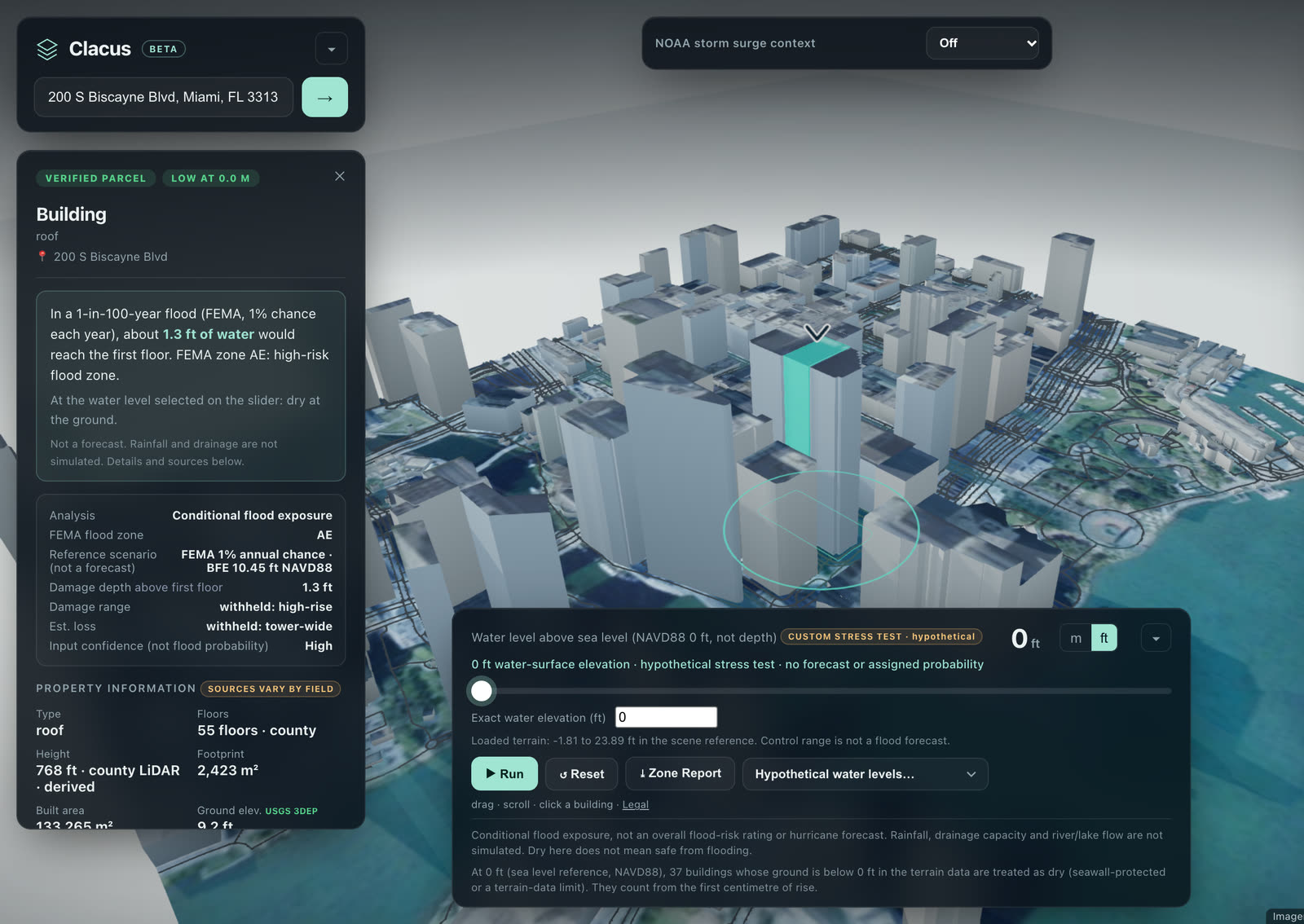
Enter an address and explore flood scenarios right on your screen. See how the property, nearby homes, and surrounding roads could be affected. Export a clear PDF to share with your realtor or insurance agent.
Quick results. Easy to read. A report you can share.
Leave your email. We’ll invite you to test Clacus when the private beta opens.
Hypothetical scenarios, not forecasts. Coverage and available property data vary.
Downtown Miami in Clacus · a hypothetical water level rising to about 2.6 ft, not a forecast · Imagery: USDA, USGS The National Map · Map data © OpenStreetMap contributors
What it does
From an address to a clearer risk picture.
Built for people who need to ask better questions before they commit: buyers, real estate professionals, insurance professionals and investors.
Get answers without the wait
Search an address and explore the available results directly in Clacus. No appointment or emailed report to wait for.
Available results vary by address and county
Look beyond the house
See how nearby homes and roads could be affected, even when the building itself stays dry.
USGS 3DEP · county footprints · OpenStreetMap · modeled roads, not real closures
Take the report with you
Export a clear PDF with sources to discuss with your realtor, insurance agent, or attorney.
Every figure keeps its source
How the scenarios work
Test a water level
Raise a hypothetical water level and see which buildings, parcels and roads fall below it, with the published FEMA flood zone for context.
FEMA NFHL · modeled, hypothetical
Compare storm surge maps
Overlay NOAA storm surge planning maps by hurricane category, Category 1 to 5, as color-coded depth bands.
NOAA · planning scenarios, not forecasts
Coverage
Florida, step by step.
The most detailed coverage is in Miami-Dade County, with live county property records. Annual assessed values are also available in seven other Florida counties: Broward, Palm Beach, Hillsborough, Orange, Duval, Lee and Pinellas.
Coverage is partial. Data availability varies by location, and a figure that cannot be verified is withheld rather than guessed.
Planning scenarios, not predictions.
Clacus does not forecast hurricanes or floods and does not give a probability for any real event. A dry scenario does not mean a property is safe. It is not an appraisal, an engineering study, a FEMA flood determination or insurance advice. Rainfall, drainage and river flow are not simulated.
Waitlist
Be the first to try the beta.
Leave your email and we will let you know when the Clacus beta opens. Joining is free and optional.
You are on the waitlist.
Thank you. We will email you when the beta opens.